When Daniel Sanborn began mapping towns 150 years ago, no one could have foreseen how his maps would continue to be used today. Nor could anyone have foreseen how the company’s headquarters that opened in Pelham in 1907 would be adapted to modern uses.
Sanborn made fire insurance maps. They seem ordinary at first glance – outlines of a few buildings and lots of obscure symbols and codes.
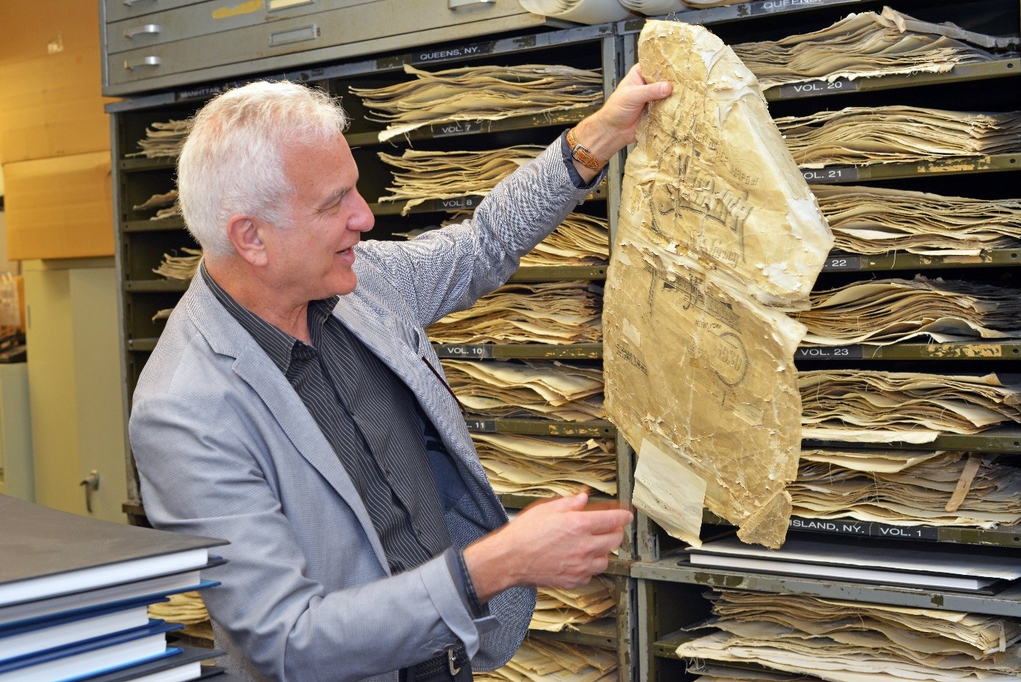
“But when you know how to read the map,” said Chris Genovese, general manager of Sanborn’s Pelham office, “people always get amazed.”
The country’s growth after the Civil War created a demand for insurance maps. The South was rebuilding. The Homestead Act and intercontinental railroads were creating a massive westward expansion. Industrialization and immigration were pumping up urban populations.
Insurance companies needed to assess their risks.
Daniel Sanborn, a surveyor from Massachusetts, began mapping locations in Tennessee for Aetna Insurance Co. in 1866. The following year he established D.A. Sanborn National Insurance Diagram Bureau in Manhattan.
Sanborn maps contain a tremendous amount of detail about buildings and neighborhoods. What’s more, the company mapped 12,000 towns and cities and updated them frequently.
The insurance maps are in effect a guide to the urbanization of America, documenting the growth of specific neighborhoods and whole cities from the 1860s on.
You can see how landscapes changed as swamps were drained for developments, a few houses became downtowns and factories were knocked down for schools.
The company quickly became one of the largest map companies. Around 1906, it needed more space and moved headquarters to 629 Fifth Ave. in Pelham.
It employed 700 people in Pelham, including hundreds of field surveyors, and cartographers, printers and other support staff.
By the 1930s, Genovese said, Sanborn was using more high quality paper stock than anyone else in the world.
Sanborn’s aerial mapping expertise was put to use for the War Department during World War II. The company worked on classified projects, and the headquarters in Pelham was under constant surveillance by the FBI, Genovese said.
The Army Map Service issued a proclamation in September 1944 recognizing Sanborn’s work.
“Without your help our mission could never be accomplished,” a colonel wrote in a follow-up letter. “Some soldier, somewhere, can do a better job and hasten victory because he is guided by a map which you produced.”
Sanborn’s insurance maps are precise and detailed. They were drawn to a large scale, 50 feet to one inch, showing four to six city blocks per page, printed on large sheets of paper.
The map books provide an index of streets and addresses, the population, the economy, wind direction, the strength of the local fire department. Railroad and rivers and other features of the landscape are noted. Public buildings such as churches, schools and businesses are named.
Each building is outlined. Windows and doors are marked, as well as sprinkler systems and fire walls. Building materials – including framing, flooring, roofing – are marked. The uses of the buildings and sometimes even of particular rooms are identified.
Fire hydrants, water and gas lines, sidewalk widths and property boundaries are shown.
As new maps were published they were sent to the Library of Congress. Around the 1920s, as cities grew rapidly, Sanborn began updating specific properties, rather than whole maps. The new drawings were pasted on the old maps, enabling users to lift the paste ups and see previous iterations.
Today, insurance companies are more likely to assess risk with actuarial tables than with maps. So who cares about old insurance maps?
The Library of Congress has an extensive collection through the 1950s, when the last complete maps were published. Genealogists and historians use them to reconstruct places and eras, track changes and make their research more vivid.
Many libraries have local sets, and so do governments and even land-use attorneys.
One of the biggest users is environmental companies. A developer, for instance, must know if hazardous chemicals were ever used on a property. Banks won’t loan money if a property hasn’t been checked, and if an environmental problem is discovered the loan can be canceled.
Governments want to know where old utility lines ran or to analyze land-use patterns.
Sanborn eventually downsized in Pelham, sold the building and moved headquarters to Colorado Springs.
Today, the company occupies a small corner of the 75,000-square-foot building. The Pelham staff still updates New York City insurance maps and provides data analysis and other services.
Just as the maps found new uses, so did the building.
It looks like a school from the street, but close up you can see how it was built like a fortress. Sanborn essentially ran a map factory with heavy presses and machine shops and stacks of flammable paper. It knew insurance, so it knew how to build a fireproof building.
It was situated on five acres in one of the first office campus-like settings in the country, according to Steve Caspi, who owns the building.
Caspi and his father, Joseph, bought the building in the mid-1980s for $400,000 in bankruptcy. It was in bad shape and there were few tenants.
Caspi spent a half-million dollars on boilers and wiring, and over the years he put in another $4 million to $5 million in renovations. Today, he thinks it is worth $10 million.
Initially, he wanted to convert it to residences, but realized it was more suited to noisy industrial businesses. After his father died in 1990, he examined the building more closely and saw potential for converting it to SoHo-like lofts.
Old carpets and layers of linoleum were pulled up, hardwood floors were sanded, brick walls were sandblasted and industrial lighting was installed in a test space.
A new tenant was willing to pay $15 a square foot, triple the amount Caspi had been charging.
“I thought wow, I can do the whole building like that,” he said.
A branch of John Hancock Insurance moved in. Then Benchmark Education Co. leased a large section. For many years the building was fully leased.
Benchmark outgrew the space and Caspi pursued smaller, eclectic tenants: a ballet studio, publisher, architects, chiropractor, financial services, construction management, fundraising and event management, and a sound recording studio. Archie Comics has 11,000 square feet.
Today, Caspi thinks he could charge a new tenant $25 per square foot.
The Sanborn Map Building represents less than 5 percent of Caspi Development Co’s portfolio. But it occupies a much bigger part of Steve Caspi’s imagination.
“I’ve always had a soft spot for this building,” he said, “because I bought it with my dad and we worked on it together for like three or four years and then he died. And he loved this building.
“I’ll never sell it. I’ve had many offers, but I would never sell it. I will hand it over to my kids when I’m gone.”